
Greetwell Ironstone Mines:
Illustrations dated September 1933 and taken by
J Rhodes of the Geological Survey.
All photographs reproduced courtesy of the British Geological Survey ©.
Map of site. Current Ordnance Survey 1:50,000 map : Some Illustrations : Some more Illustrations
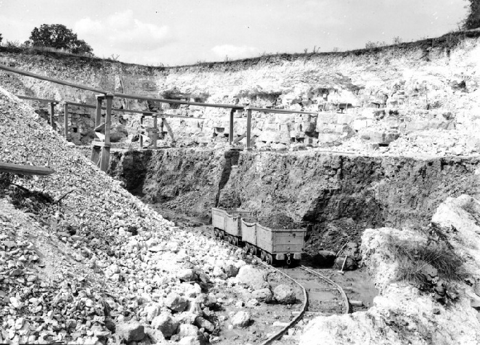
Wilson Mine, Mid Lincoln Ironstone Mines, Greetwell.
Looking N. Lincolnshire Limestone overlying Northampton Ironstone, Greetwell. The limestone, part of the Inferior Oolite, shows light in the photograph; the ironstone, containing about 33 per cent iron as mined, is dark’.
BGS Ref: P206247
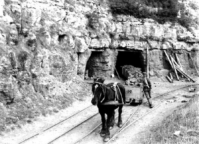
Long Harry Mine, Mid Lincoln Ironstone Mines, Greetwell.
Looking N. Lincolnshire Limestone overlying Northampton Ironstone, Greetwell. Similar section to last (P206247). Trucks leaving the Long Harry Mine, laden with ironstone.
BGS Ref; P206248
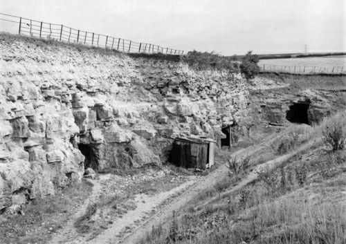
Long Harry Mine, Mid Lincoln Ironstone Mines, Greetwell.
Looking N. Lincolnshire Limestone overlying Northampton Ironstone, Greetwell. The view shows disused adits of Long Harry Mine.
BGS Ref; P206249
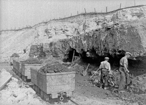
Long Harry Mine, Mid Lincoln Ironstone Mines, Greetwell. Looking N. Lincolnshire Limestone overlying Northampton Ironstone, Greetwell. The picture shows men working out the ironstone at the quarry-face, Long Harry Mine.
BGS Ref; P206250
| Trek Reports 1 The early years |
| Trek Reports 2 Everest 1992 |
| Trek Reports 3 Muktinath 1997 |
| Trek Reports 4 Helambu & Langtang 1999 |
| Trek Reports 5 The Annapurna Circuit |
| Trek Reports 6 Khumbu 2003 |
| Annapurna Circuit Trek Intinerary 2001 |
| Khumbu Trek 2003 Itinerary |
| Deep C Production List |
| Deep C Models - 'Festivale' & 'Island Breeze' |
| UK Mini-Ship Shows - a retrospective list |
| Burton Gravel Pits Railways |
| Greetwell Ironstone Mines & Quarries |
| Lincoln West End & Newsums Works |
| Railway Operating Maps & Diagrams - Lincoln District c1955 |
| Wolds Apart Previous Programme |
| West Gallery at Whitby Folk Week |
| Gordon Corrick - In Memoriam |